Table of Contents
Apps like Waze have redefined how people move through cities. They do more than just show directions—they report road hazards, traffic jams, construction, and accidents in real time.
If you’re considering building your version of such an app, you’re stepping into a space where accuracy, speed, and user trust are critical.
This guide breaks down what goes into creating a Waze-like navigation app, the essential features to include, what the development process looks like, and how much you should budget.
Shiv Technolabs has helped businesses build location-based apps from the ground up, and we’re here to share our experience.
What is GPS, and How it Helps in Navigation?
GPS, or Global Positioning System, is a satellite-based technology that pinpoints your exact location anywhere on Earth. It works by receiving signals from a network of satellites orbiting the planet. Your device calculates its position by measuring the time it takes for signals from multiple satellites to reach it.
GPS helps us navigate faster by:
- Determining your real-time location with high accuracy
- Calculating the quickest route to your destination
- Adjusting directions instantly when you take a wrong turn
- Providing updates on traffic delays, road closures, or accidents
By combining GPS with live traffic data, navigation apps can find faster, smarter routes—helping you avoid slowdowns and reach your destination efficiently.
Waze App – What is it and How it Works?
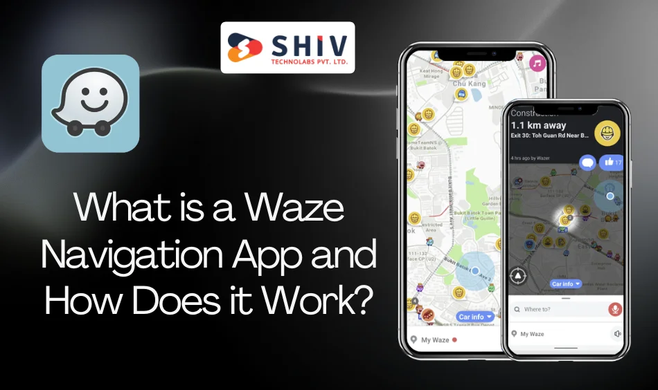
A Waze navigation app is a real-time GPS app that guides users using live traffic data and user-generated reports. Unlike standard navigation tools, it lets users report accidents, traffic jams, road closures, and other driving conditions.
With advancements in mobile app development, these apps are now more responsive and interactive, offering smarter features and a smoother user experience.
The app collects GPS data and user inputs, processes them instantly, and suggests the fastest routes. If conditions change, it reroutes drivers on the go. Users get voice directions, visual alerts, and a constantly updated map powered by community feedback.
It’s a smart, interactive way to help drivers avoid delays and reach their destination efficiently.
Key Features of the Waze App
Waze provides a comprehensive set of features to enhance the driving experience:
- Real-Time Navigation: Offers turn-by-turn directions with live traffic updates.
- Crowdsourced Alerts: Users can report accidents, hazards, and police sightings.
- Dynamic Rerouting: Automatically adjusts routes based on current road conditions.
- Speed Limit Notifications: Alerts when exceeding posted speed limits.
- Lane Guidance: Provides information on the correct lane to be in for upcoming turns.
- Voice Navigation: Includes various voice options for navigation prompts.
- Map Editing: Users can contribute to map accuracy through the Waze Map Editor.
Additional Features for Your Waze-like App
Depending on your niche and target audience, you might want to expand the app’s capabilities with some of the following:
- Integration with wearable devices
- Real-time weather data
- In-app advertising or promoted locations
- Emergency SOS button
- Support for offline maps
- Local business listings
These features can differentiate your app, especially in crowded app stores.
Process to Build a Waze-Like Navigation App
Creating a Waze-style navigation app requires a precise, technically layered process. This isn’t a typical mobile app—it deals with moving data, real-time updates, map intelligence, and community engagement.
Below is a step-by-step approach that reflects the unique engineering and planning demands of such a product.
# Set the Foundation: Define Objective, Coverage Area, and Map Source
Start by identifying the exact purpose of the app. Ask what segment of travel or transport your app will serve: daily commuters, logistics companies, or a niche like ride-sharing for rural zones. Then, define your geographical scope—will you begin city-specific or launch across multiple regions?
Next, choose a map provider. This decision will shape how you handle routing, traffic overlays, and geolocation precision. Common options include:
- Google Maps SDK
- Mapbox
- HERE Technologies
- TomTom
Each platform comes with different licensing terms, refresh rates, customization flexibility, and usage limits. Picking the wrong one can limit your app’s capabilities down the line.
# Build a Real-Time Location and Communication Layer
A core requirement is the ability to manage real-time GPS data from users and broadcast information across the app instantly. Traditional REST APIs won’t suffice. You need a persistent, two-way data flow.
Key steps include:
- Use WebSocket or MQTT protocols to manage live communication.
- Set up a scalable backend to process frequent location pings.
- Add tracking logic that balances accuracy with battery efficiency.
- The goal is to keep location data flowing with minimal delay, without overwhelming mobile devices or your servers.
# Develop a Custom Event Reporting Engine
What makes Waze different is its user-powered event system. Drivers report traffic, accidents, road closures, or hazards. Your app should offer the same, but with clean moderation logic.
Include the following elements in your reporting module:
- Tagging location and event type
- Time-stamped event expiration (auto-removal after X minutes)
- User confirmation (thumbs-up/down to validate reports)
- Impact flag (to influence route calculation in real time)
This engine should be able to plug directly into your routing algorithm so that live reports can trigger detours automatically.
# Build a Smart Route Calculation System with Re-Routing Logic
Your app must do more than follow a GPS line—it must think like a driver. Build a routing layer that adapts to road reports, speed patterns, and sudden traffic.
Here’s what to focus on:
- Real-time rerouting based on current data
- Alternate route suggestions, not just a single path
- Historical data reference (for example, weekday rush-hour behavior)
- Ability to avoid user-tagged hazards
Some map APIs provide basic routing, but for advanced performance, combine your rule engine with external routing services. This creates a tailored experience that adjusts based on context.
# Design a Fast, Clean, Mobile-First Frontend
On the frontend, your interface needs to support real-time movement, user interaction, and multi-threaded updates. This isn’t just about design—it’s about usability at 60 mph.
Key UI/UX components:
- Real-time animated map with smooth marker transitions
- Voice-guided turn-by-turn directions
- Minimal taps for event reporting (ideally one gesture)
- Quick-switch map layers (day/night, traffic on/off)
Build for both Android and iOS, using native or hybrid frameworks based on your timeline and budget. Prioritize low latency and battery-friendly features.
# Integrate Voice Controls and Audio Feedback
A modern navigation app should work with voice. This keeps users focused on the road and adds value to the experience.
Implementation points:
- Voice input for commands like “Report traffic” or “Find a gas station”
- Spoken notifications for reroutes or upcoming incidents
- Basic NLP (Natural Language Processing) support to understand flexible commands
- Option to personalize navigation voices or languages
These features also improve accessibility, making the app usable by more people in different contexts.
# Add Community and Gamification Elements
Waze gained traction by turning users into contributors. You can do the same by rewarding engagement and making users feel like part of a community.
Gamification features to consider:
- Point system for validated reports
- Badges or ranks for top contributors
- Weekly leaderboards by city or area
- Social sharing for helpful alerts
This encourages participation and helps grow your app’s data pool organically, making your system more accurate over time.
# Stress-Test for Real-World Traffic Conditions
Testing a navigation app isn’t just about checking for bugs. You need to simulate heavy traffic and live driving situations to measure response times and reliability.
Simulate the following scenarios:
- 500+ users reporting incidents in a 5-mile radius
- Route recalculation under multiple overlapping reports
- Intermittent network conditions (switching from Wi-Fi to 4G)
- Backend load spikes during peak travel hours
Use location simulators and automation tools to recreate these edge cases. Make sure your servers and app can perform under pressure.
# Address Regional Map Licensing and Compliance Requirements
If you plan to operate in different countries or jurisdictions, you must account for regional rules around data privacy, GPS accuracy, and content regulations.
Consider:
- Map licensing restrictions by country
- Compliance with GDPR, CCPA, or other local privacy laws
- Storage location for GPS logs and personal data
- Anonymization options for user tracking
Consult with legal and data experts early to avoid major pivots later.
# Launch in a Controlled Region and Scale Gradually
Start small. Pick one urban or suburban zone that reflects your target users. This gives your app a testbed for real-time performance, user reporting accuracy, and support needs.
Why a staged launch works better:
- You collect controlled feedback
- Bugs and performance issues stay localized
- You can train your backend systems with real-world data
- You build local community traction before going wide
Expand city by city, adjusting your routing logic, infrastructure, and user engagement plan based on how people interact with your app in the real world.
Cost to Build a Waze-Like Navigation App
Costs vary based on complexity, team size, and the platforms you’re targeting. Here’s a rough estimate to guide your planning:
- MVP (Minimum Viable Product): $40,000 – $60,000
- Full-feature app with real-time traffic and user reporting: $80,000 – $150,000
- Enterprise-level solution with multi-language, offline mode, and ad integration: $200,000+
Additional factors that impact cost:
- Real-time traffic data licensing (from providers like HERE, TomTom, or Google Maps)
- Server and cloud infrastructure
- Third-party integrations (weather APIs, gas prices, etc.)
- Ongoing maintenance (usually 15–20% of initial development cost annually)
Build Your Navigation App – Shiv Technolabs
Shiv Technolabs is a trusted partner for companies looking to build intelligent, responsive, and high-performance mobile apps.
Our team has delivered robust navigation-based applications for transport, delivery, travel, and automotive clients.
Here’s what you can expect when working with us:
- Deep technical experience in location-aware services
- Proven project planning and milestone tracking
- Full-cycle development from design to launch
- Transparent communication and timelines
- Strong post-launch support with frequent updates
Whether you’re building an MVP or a fully scaled product, we align with your goals and focus on creating a reliable user experience backed by powerful technology.
Summing Up
Building a navigation app like Waze is an ambitious project, but the payoff is worth it. With the right strategy, features, and team, you can deliver a product that helps people travel smarter, save time, and stay informed on the road.
If you’re ready to start building your GPS-based app, Shiv Technolabs offers full-stack navigation app development services tailored to your needs.
Reach out to our team today to discuss how we can help bring your idea to life with precision and clarity.


